Hurricane Season: Month 2
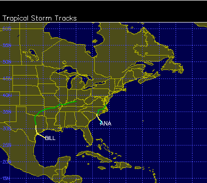
Hurricane season 2015 began with a flurry of activity. Pre-season Ana struck North Carolina and Bill brought heavy rain to Texas. Since then, things have slowed down, which is pretty typical heading into the second month.
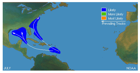
Early season storms usually occur close to the U.S. In July, we usually watch the Atlantic heat up and wait for waves begin to emerge off the West coast of Africa. This map shows the climatological tracks of July storms:
 The developing El Niño is expected to have a significant impact to the rest of the season. Here’s the scenario: rapid warming of equatorial Pacific waters increases the jet stream over the Atlantic. This additional shear tends to choke developing storms. It’s still early, so we’ll have to see how this projection shakes out over the next few months.
Meanwhile, there has been a different kind of trend off the West African coast lately. These images show a large amount of Saharan dust being transported across the Atlantic:
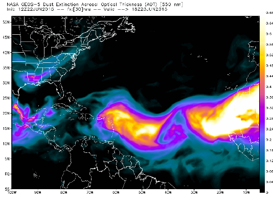
The result has been hazy skies in places like southeast Texas, Louisiana, north Alabama and Georgia.
A quiet second month would be a nice trend, but we have about six weeks until we enter the peak of the season. If you live in a coastal region, these quiet periods are great times to review your plans and get supplies…just in case.