Hurricane Joaquin
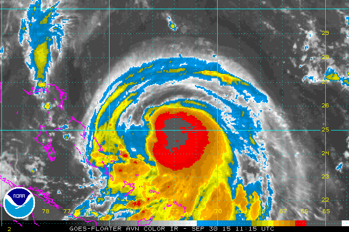
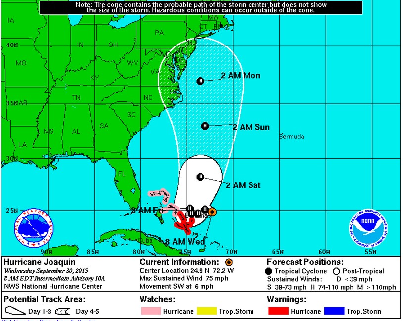
Joaquin (wah-KEEN) became the second hurricane of the 2015 Atlantic season and unlike the first, Fred, this storm could pose a threat to the U.S. The newest track from the National Hurricane Center may put some on the east coast on high alert because the forecast has Joaquin possibly growing to category 2 strength over the weekend. There is still a great deal of uncertainty as to where and if it makes landfall:
Hurricane warnings are up for the southern portion of the Bahamas. Joaquin will be around for a while because unlike earlier Caribbean storms this year, Joaquin won’t be fighting upper-level shear. In fact, the winds aloft are fairly light and the storm will be able to feed on very warm water in the region. Additionally, once the storm begins to take a northward jog early in the weekend, it will be drawn northward by a weak upper-level low over the southeast U.S.:
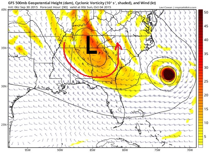
The strength and location of the low will have a large impact on Joaquin’s destination. Already, a few long-range models are projecting some kind of U.S. landfall by the end of the weekend. Here’s a sampling from the HWRF, GFDL and GFS:
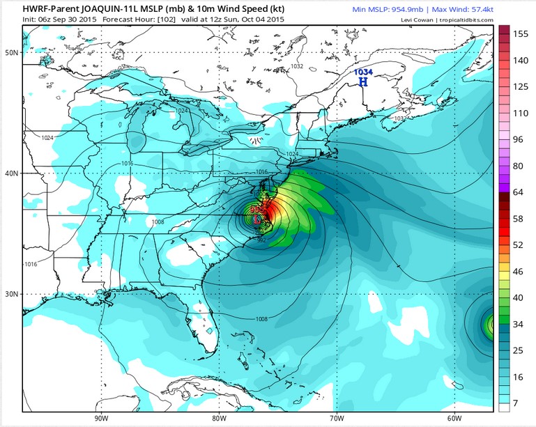
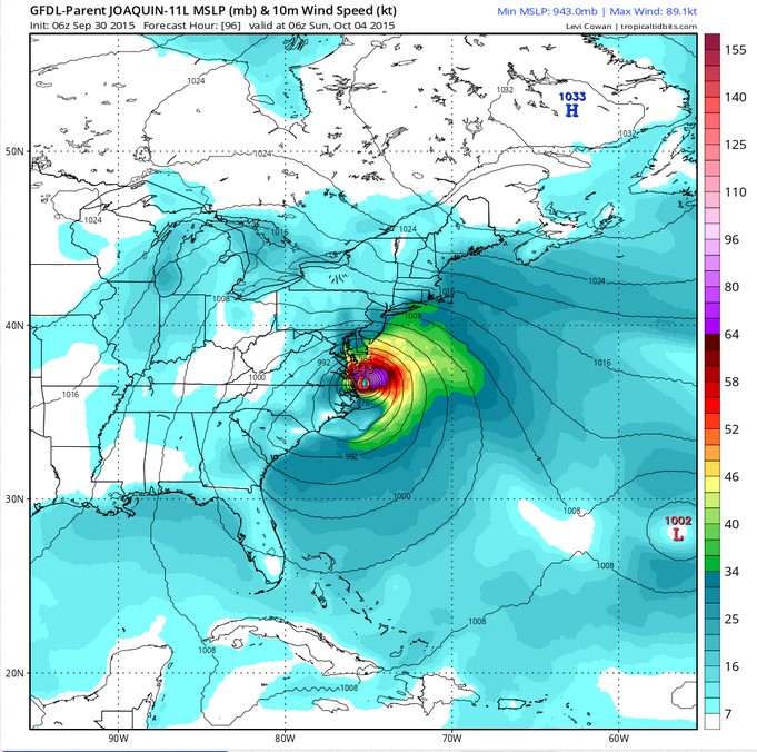
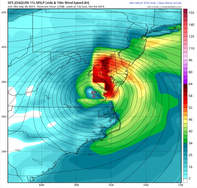
Remember, these are only projections of what could happen. However, if they are accurate, it spells big problems for the Mid-Atlantic region of the U.S. There has already been quite a bit of rain on the east coast and Joaquin is raising flood fears. Any topical system needs to be watched and Joaquin is no exception, especially with the large uncertainty in the track. Check back here for more updates.