Mid-west storm threat for Veteran’s Day
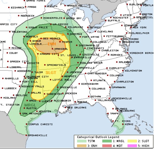
There is an enhanced threat for severe weather Wednesday, Veteran’s Day as indicated above. Areas in orange and yellow have the highest risk. The timetable for the storms to develop is late morning through the early evening with the storms moving from west to east through the region. Stay alert if you are in the threat areas and be sure you have a reliable way to receive specific weather warnings. Consider getting a WeatherCall subscription by going to this link: try.weathercall.net/signupnow.
It really isn’t that unusual to see this kind of storm threat this time of year. Traditionally, we expect severe weather in the months of March, April, May and June. However, there is a smaller, secondary severe weather season from mid-October through early December. During this time, there are usually strong and dramatic clashes between cold air descending from Canada and any residual warmth from the fall. You may recall that just last week, record highs were set in many locations east of the Mississippi.
This week, a vigorous area of low pressure will develop in the southern plains and trek eastward into the Midwest. It will drag a cold front across the lower Mississippi River Valley and the Southeast. Some strong storms will develop along that front , but the bigger storm threat will be concentrated around the low itself. There, a surge of jet stream energy could allow for some of the storms to rotate, increasing the likelihood of tornadoes.
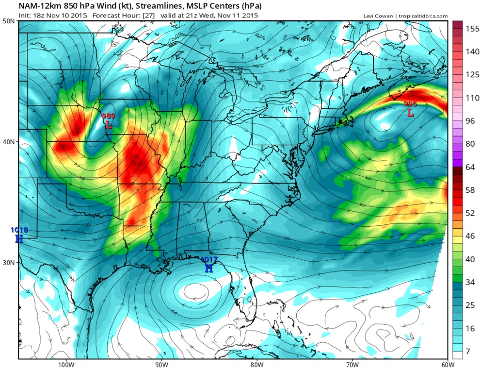
In most severe storm set-ups, there are three main ingredients that I look for – low-level moisture, lift and wind shear. First, let’s look at the low-level moisture, streaming into Arkansas and Missouri indicated by the splotches of red in this depiction of Wednesday afternoon:
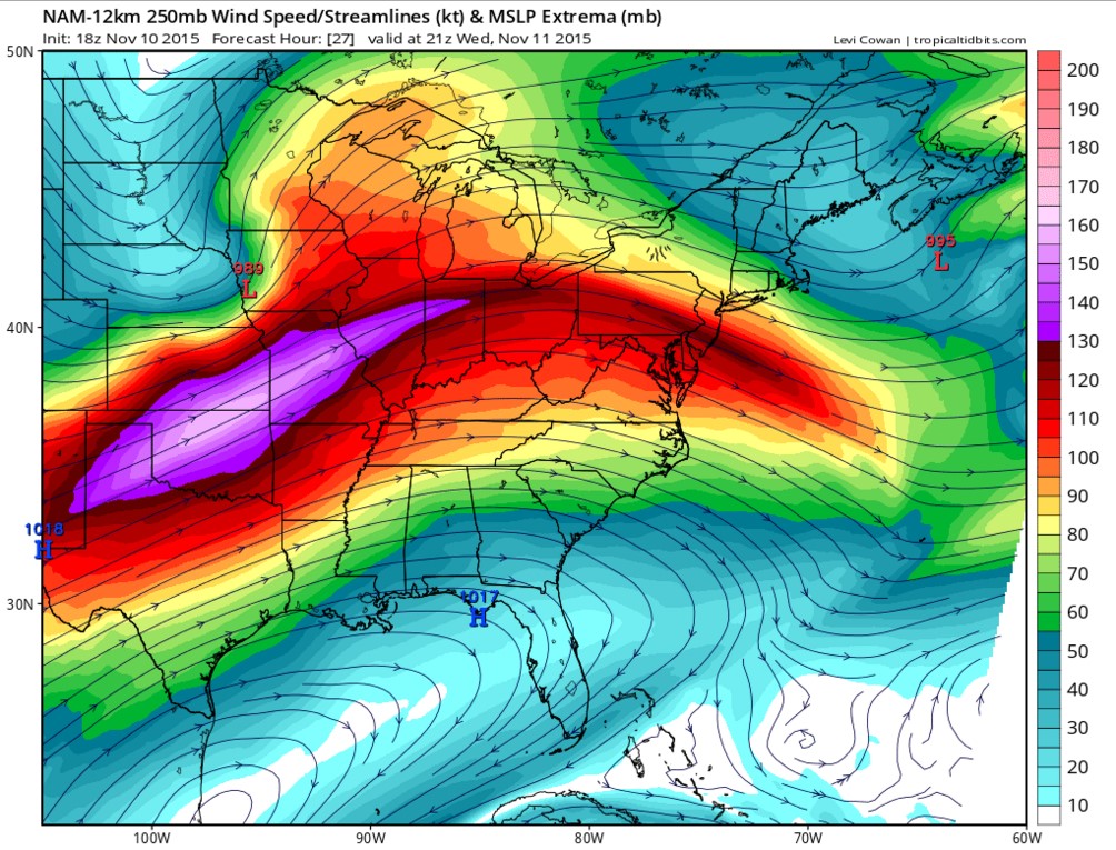
Jet stream winds at the same time are projected to be nearly perpendicular to that low-level flow as indicated by the region of purple:
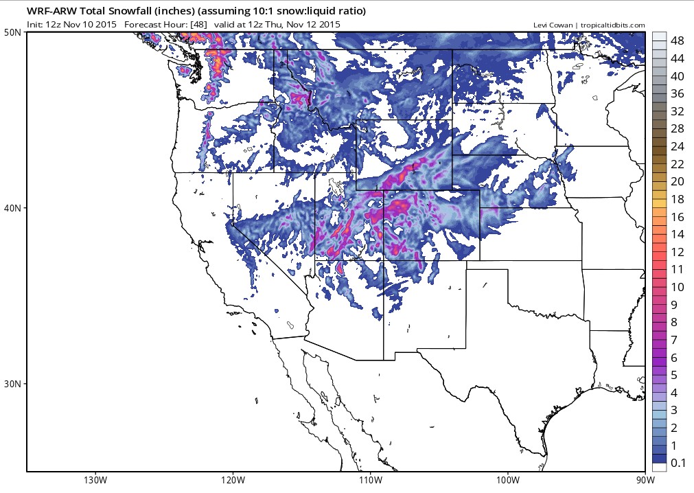
Additionally, on the back side of this system, enough cold air arrives to drop significant snowfall in the Rockies. Here are some projections for snowfall there. Note the purple splotches over 6″ in parts of Wyoming, Utah and Colorado:
So, recapping the severe weather threat. Here is a depiction of where storms will likely be late Wednesday afternoon:
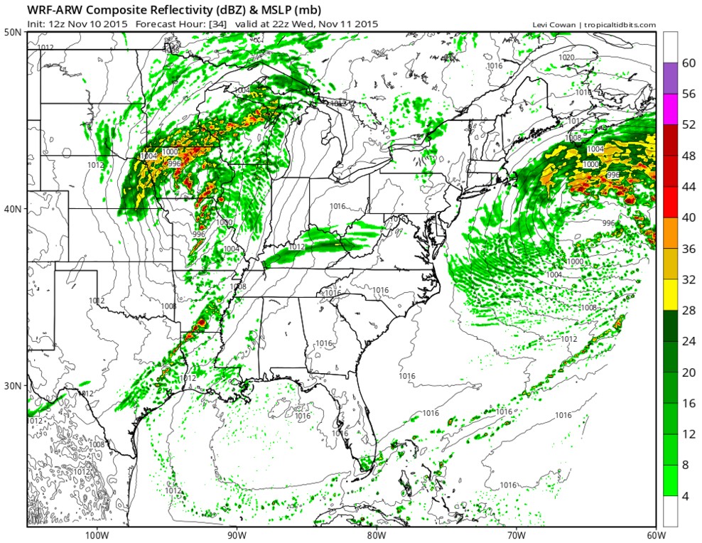
Notice the threats are strongest in Iowa and Missouri but notice the thin finger of storms stretching from Louisiana into east Texas.The nature of the storms will be more isolated and those that form could bring isolated tornadoes, damaging wind and tornadoes.
Again, stay alert in the threat areas and have a plan, which begins with having a way to get the warnings when they are issues. Then, know where you would go and what you would do if severe storms were headed your way.