Winter lurks on the horizon

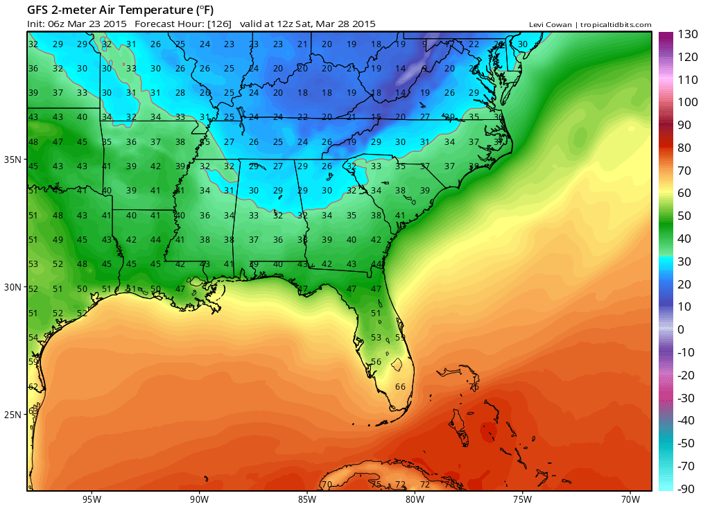
2 pm temperatures Wednesday 8 am temperatures Saturday
After a soggy, cool weekend, most of the Southeast is poised to dry out and warm up a bit through the middle of the week. However, a strong early Spring cold front is poised to slide in from the north by the end of the week. Rain and possibly a few storms should break out ahead of the front as it moves in Thursday. Keep your coats and jackets ready, thought because by Friday, temperatures will be falling all day heading to some freezing cold mornings Saturday and Palm Sunday.
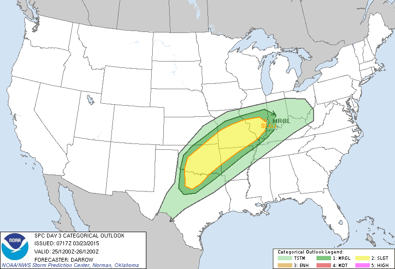
Thankfully, this front will likely spare the southeast from any rough weather. However, Wednesday and Thursday could be quite bumpy through the southern Plains. The Storm Prediction Center indicates a slight risk of severe thunderstorms, indicated by yellow from north Texas to extreme southern Illinois:
This is the kind of pattern that, if it holds, could be a harbinger of an active spring storm season ahead.