Here Comes Mr. Bill!

Looking at the satellite picture above, I’m reminded of the old saying, “if it looks like a duck and quacks like a duck – its a duck”. The blob of clouds in the western Gulf “looks” like a developing tropical system and indeed, at 10 PM EDT, the National Hurricane Center upgraded the disturbance to Tropical Storm Bill
Air force reconnaissance planes have been flying in and out of this mass of clouds for the last two days trying to identify what’s going on. Tonight, they identified maximum sustained winds of 50 mph. The surface reports from buoys in the Gulf has shown a broad circulation, with strong winds north and east of where the center is located. Here’s an example of the observations from 9PM EDT:
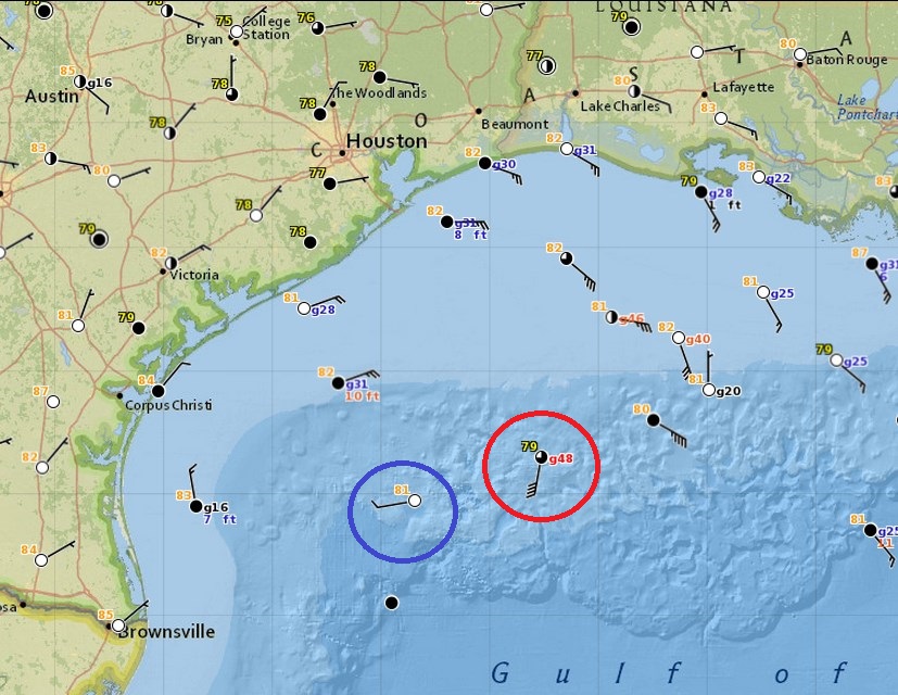
The buoy circled in red stands out – southerly winds at 40 kts (46 mph) and there are buoys north and northeast of that one with 20-40 mph winds being reported. However, the buoy circled in blue is showing a west wind, instead of, say, a north one. So the circulation, while indicating a counter-clockwise orientation isn’t tightly organized. However, pressures have been dropping, indicating that the system will likely strengthen overnight.
The latest track forecast from the hurricane center shows that Bill will likely make landfall somewhere near Matagorda Bay by daybreak Tuesday morning:
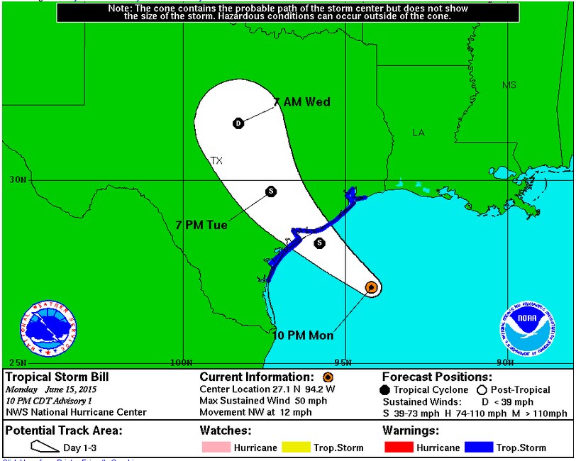
Its always important in tropical storms and hurricanes not to focus just on the track and the circled “S”. While that is where the center of the storm is, the impacts extend beyond that. Typically, rainfall is heaviest east of the track, where places like Austin, Houston and Galveston should expect to see training rainfall that could lead to flash flooding. One good thing about this whole scenario is that Bill is expected to move steadily as it rotates around the edge of a large high pressure cell parked over the southeast U.S.