Danny Diminishes, now – enter Erika

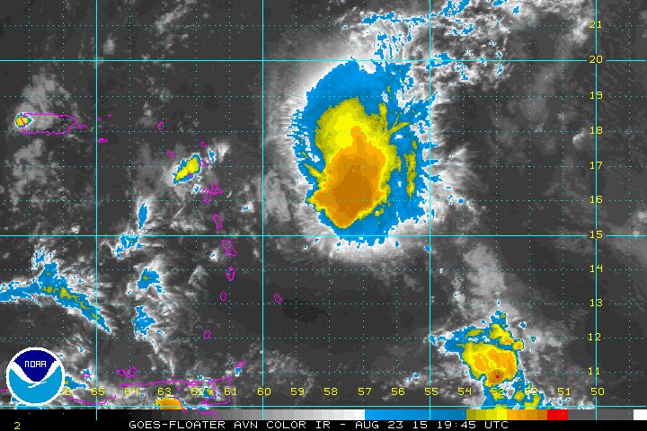
Heading into the peak of hurricane season in the middle of September, activity in the Atlantic is picking up. Last week, Danny formed and when it was upgraded to Category 3 status, there was some speculation that it might threaten parts of the Caribbean. However, by the middle of last week, it became apparent that Danny would run into high shear and dry air which would weaken it considerably. In fact, that is what happened. By Sunday morning, Danny was a Tropical Storm threatening to bring needed rain to Puerto Rico by Monday. Widespread damage is not expected, but tropical storm warnings are in effect for several islands in the Leeward chain including Antigua, Barbuda, Montserrat and St. Kitts. Here is a look at a satellite image from late Sunday afternoon:
Danny is the first in a series of waves that developed off the West Coast of Africa. Next in line is the wave designated as 98L, which will likely become Erika in the next few days. It appears that this storm will follow a similar path as Danny. Here is a projection of where Erika could be by Thursday of this week; once again impacting the Leewards:
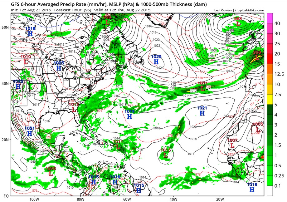
However, it appears that Erka could suffer Danny’s fate as the same plume of southwesterly winds over the eastern Caribbean produces the same storm-suppressing shear:
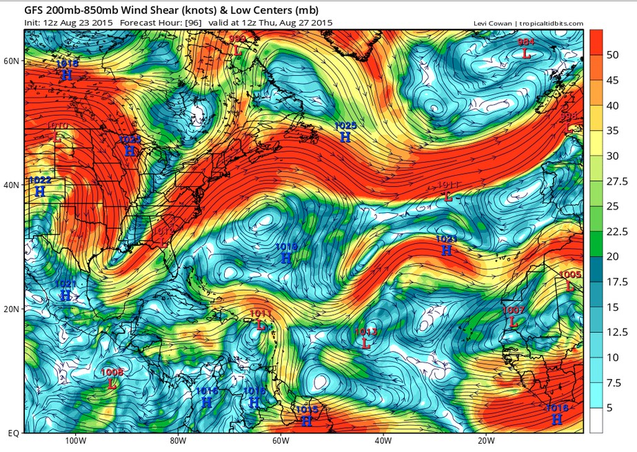
Even if Erika was to somehow survive, it would run into even stronger shear from the mid-latitude trough in the eastern U.S. As I noted at the beginning of this post, the activity off the African coast could continue over the next few weeks. While this may create on-line excitement and somewhat exaggerated projections of landfall impacts, each storm needs to be followed in the environment in which it forms. My motto – stay tuned and stay alert.