The End of Erika? – Not quite yet

The very disorganized fifth-named storm of the season is getting harder and harder to find, making the forecast more difficult. As of Saturday morning, the National Hurricane Center is poised to discontinue issuing advisories on Erika.
A lot will become clearer when the hurricane hunter’s data comes into the models today. Friday, the forecast track kept shifting westward, raising concerns in the Gulf and Florida. However, the models may have had a faulty initialization on the starting position of the storm. The system was so lopsided with most of the convection east of the center. Now, it is even more disorganized making the forecast even tougher. Here is the forecast from various computer models as of Saturday morning:
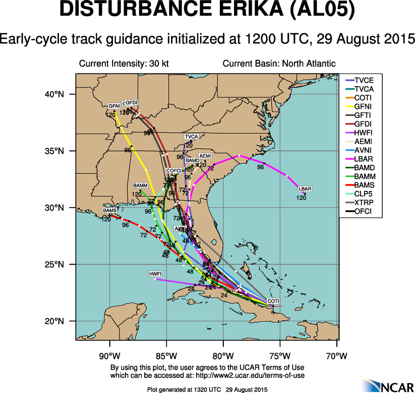
Once skirting the northern coast of Cuba, there is a great difference of opinion, although many models tend to move it into the warm Gulf. Florida will still likely get a soaking, which they need after the drought they’ve been in recently.
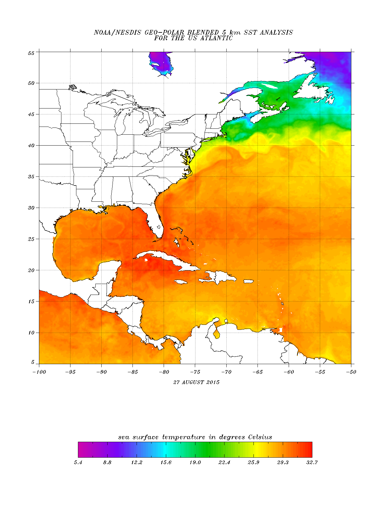
As expected, Erika is finding the jagged mountains of Hispanola a great challenge to overcome. Even still, the loosely disorganized wave of low pressure may still have a chance to re-develop if it can make it past Cuba. The waters between there and Florida are very warm, at or above 85 degrees:
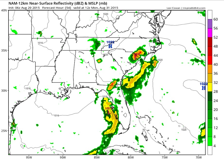
The upper-level steering environment is slightly favorable for development and a bit complicated. In the northwest Gulf now, there is a weak area of low pressure, which could tend to drag Erika’s remnants northward. Just east of Florida, there is a weak high pressure ridge, nudging it west. There is now a chance that Erika could re-form in the Gulf of Mexico and move northward along Florida’s west coast. Here is a projection for Monday morning:
Check back for more updates over the next few days.