Let The Season Begin
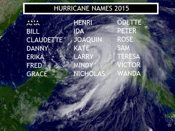
Oh, wait – the 2015 Hurricane Season has already begun! Even though we normally mark June 1 as the kickoff, Ana got things started early when it formed nearly a month ago. The storm’s maximum sustained winds strengthened to 60 mph before making landfall near Myrtle Beach on Mother’s Day. Despite the early arrival of the first storm, the season, which lasts through the end of November, is expected to be “less active” than normal. The official forecast from the National Hurricane Center calls for between 6 and 11 named storms, with 3 to 6 of those becoming hurricanes. There may be up to two hurricanes that reach major (winds over 110 mph) status. The names on this year’s list are shown above.
The reason for the reduction in activity is linked to the expected El Nino, which is already taking shape. This phenomenon of warmer Pacific ocean temperatures near the equator influences Atlantic storm formation. Jet stream patterns, altered by El Nino, allow for more shear to develop in the hurricane zone. The less favorable environment for storm development could limit how many form. However, as always, there is a caution to this reasoning.
While El Ninos may reduce the total number of storms that form, it doesn’t mean that there won’t be an impact from the tropics. Both 1983 and 1992 were El Nino years, which produced the quickly-forming Alicia that struck Houston and Galveston and Andrew, the last Category 5 storm to ravage the U.S. Notice that both of those storms begin with “A”. The remainder of each of those years indeed contained a small number of total storms (four and seven, respectively), however, the first ones created a lasting memory.
If you live along the coast, preparedness is the watchword you should embrace. If you live inland, don’t overlook the land-falling impacts of hurricanes and tropical storms. Few recall that Katrina spawned a record 18 tornadoes in north Georgia, hundreds of miles from devastated New Orleans. Alberto in 1994 washed away roads in central Alabama and Georgia.
Despite Ana’s pre-season debut, typically, storms that form in June tend to develop in the Caribbean and Gulf of Mexico. True to form, there may be something developing later this week south of Florida. The long-range, U.S.-based GFS model depicts low pressure there by Friday, strengthening near the Bahamas Saturday:
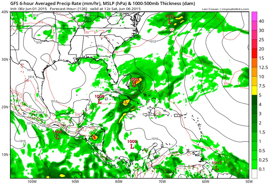
Currently, due to high pressure in the southeast, the low, if it becomes Bill, will remain in the Atlantic and not threaten land. Stay tuned and stay prepared – we have a long six months to go.