Destined to be Danny?

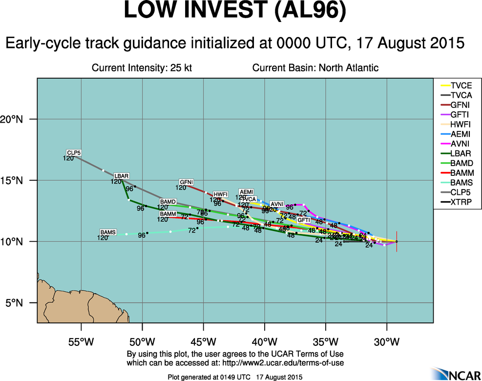
According to the National Hurricane Center, the circled mass above in the far eastern Atlantic has a 50% chance of developing into a tropical cyclone over the next 2 days. Not surprisingly and as indicated in the last post on this blog, mid-August is a time when waves coming off the west coast of Africa develop as they move across the ocean. High pressure in the middle of the ocean steer these waves toward the U.S. However, a recent pattern of east coast troughs will likely deflect any approaching system from having an impact. When the maximum winds in this circulation reach 39 mph or higher, it will get the name Danny. Until then, it has the designation 96L and models initially indicate that Danny will gain tropical storm strength:
The long-range GFS model indicates that Danny could be followed by a few more other waves making their way across the Atlantic by the end of the month.